News
Dec. 7, 2022
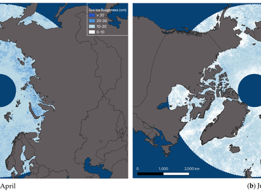
A new study has demonstrated the use of data from the NASA Multiangular Imaging SpectroRadiometer (MISR) satellite instrument to derive Arctic-wide maps of sea ice roughness for the Arctic.
June 10, 2022
The MISR team at the Jet Propulsion Laboratory (JPL) and NASA’s Atmospheric Sciences Data Center (ASDC) announce the release of a new online aerosol plume visualization and analysis tool, the MISR Enhanced Research and Lookup Interface or MERLIN.
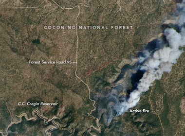
Sept. 1, 2020
Earth-observing instruments on satellites and aircraft are mapping the current fires, providing data products to agencies on the ground that are responding to the emergency.
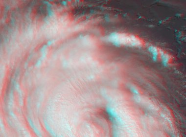
Aug. 28, 2020
This perspective can help researchers spot features in a hurricane, including those that could indicate whether a hurricane will intensify or weaken.
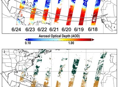
June 26, 2020
Every year around 200 million metric tons of dust – a mass of more than 600 Empire State Buildings – blows off the Saharan Desert in North Africa and out over the Atlantic Ocean.
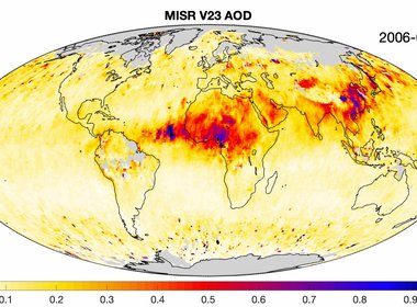
Feb. 10, 2020
JPL and NASA Langley Atmospheric Data Center (ASDC) released a new version of the MISR aerosol products, which feature significant improvements.
Jan. 29, 2020
After more than 20 years in space, the five instruments aboard NASA’s Terra satellite continue their singular achievement of compiling a climate data record of Earth.
March 22, 2019
On Dec. 18, 2018, a large "fireball" — the term used for exceptionally bright meteors that are visible over a wide area — exploded about 16 miles (26 kilometers) above the Bering Sea.
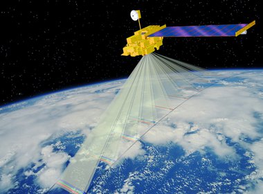
Oct. 16, 2018
More than 400 miles above Earth, a satellite the size of a school bus is earning its frequent flyer miles.
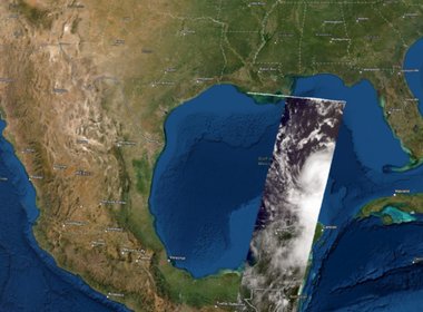
Oct. 10, 2018
Many NASA instruments are keeping tabs on Hurricane Michael from space, including AIRS and MISR. Here's what they've seen.
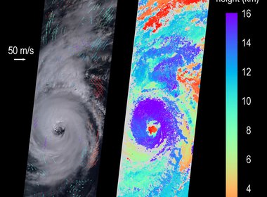
Sept. 13, 2018
MISR passed over the hurricane Thurs., Sept. 13, as it approached the eastern coast of the U.S. and captured the storm in 3D.
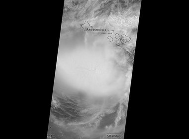
Aug. 24, 2018
NASA's Multi-angle Imaging SpectroRadiometer (MISR) captured images of Lane on just before noon local time on Aug. 24.
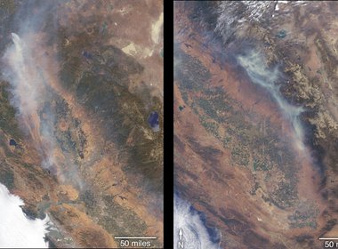
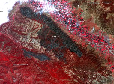
July 31, 2018
More than a dozen wildfires are burning in the state of California. MISR imaged two of them from space.
May 15, 2018
Since plumes can disperse over vast areas, satellites are particularly useful for monitoring them. For instance, MISR acquires stereo images that can be used to measure the height of volcanic plumes.
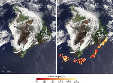
May 9, 2018
In April 2018, an abandoned campfire in Arizona grew into a fast-moving wildfire that charred more than 50 square kilometer. On April 30, MISR captured information about the height of the smoke plume.
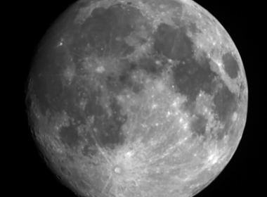
Aug. 19, 2017
NASA’s Terra satellite was built to observe Earth, and for more than 17 years its imagers have looked downward for 24 hours a day. However, the satellite recently trained its eyes on a different celestial body.
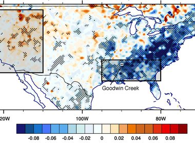
Aug. 11, 2017
During the 20th century, the average temperature of the continental United States rose by almost 1 degree Fahrenheit (0.5 degree Celsius) -- everywhere, that is, except in the Southeast.
May 5, 2017
Climate change may eventually change global cloud heights, but scientists need a longer data set to know whether that's happening already.
Nov. 21, 2016
The science team behind MISR frequently publishes special images called stereo anaglyphs. But what exactly is an anaglyph, and how is one made from MISR data?

Nov. 7, 2016
The AirMSPI scientists spoke about NASA’s current and future role in aviation and answered questions from the public.